
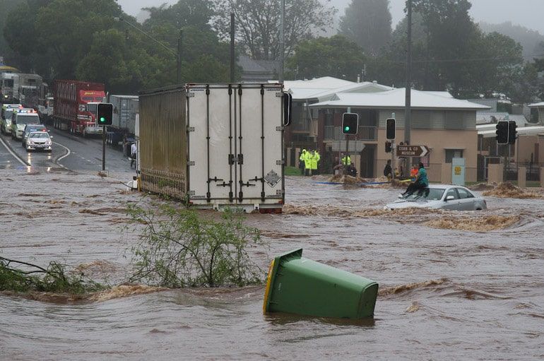
A state of heightened alert (Code Red) is set by Wednesday 21 to Thursday 22 January 2026 five regions of the country, due to the upcoming bad weather that is expected to hit much of Greece with intense and dangerous phenomena.
The morning of Tuesday 20 January the Risk Assessment Committee met, in the presence of the Minister of Climate Crisis and Civil Protection Yannis Kefalogiannis, on the subject of the bad weather wave which, according to estimates, will occur from the early hours of Wednesday morning until midday on Thursday.
According to the scientists of the Commission, which was convened by the Secretary General for Civil Protection Nikos Papaevstathiou, expected:
Heavy showers and thunderstorms on Wednesday in Eastern and Southern Peloponnese (mainly Messinia, Laconia, Argolida and Corinthia), Eastern Central Greece, Evia, Attica, Eastern Thessaly and Sporades. From Wednesday evening to midday on Thursday, the phenomena will extend to the islands of the northern and eastern Aegean and the Dodecanese.
Snowfall on Wednesday in the mountains and semi-mountains of the mainland, with particular intensity at lower altitudes in western Thessaly and western Macedonia, mainly in areas of Trikala, Karditsa, Evritania and Karditsa.
Gusty winds 8 to 9 Beaufort, in places until Wednesday noon in the northern Ionian Sea and until Thursday morning in the central and southern Aegean Sea.
Following the issuance of the Dangerous Weather Emergency Bulletin by the National Weather Service, the General Secretariat for Civil Protection put the Regions in a state of mobilization Attica, Peloponnese, Peloponnese, Central Greece, Thessaly and Western Macedonia.
In this context, Municipalities and Regions are invited to immediately convene the Local and Regional Operational Civil Protection Coordination Bodies (LCCBs and RCCBs), while it is recommended to limit travel to the minimum necessary in the areas put on red alert.
At the same time, the National Coordination Centre for Operations and Crisis Management is in constant communication with the first and second level local authorities and all stakeholders, in order to have full operational readiness to deal with the phenomena.
Finally, it is recalled that, according to current legislation, drivers are obliged to carry appropriate anti-skid equipment in their vehicles, especially in areas where snowfall or frost is expected.
⚠️⚠️⚠️EΚΤΑΚΤΟ DANGEROUS WEATHER PHENOMENA BULLETIN
✅Bad weather is forecast in our country tomorrow Wednesday 21-01-2026 and until noon on Thursday 22-01-2026 with the main features of heavy rains and thunderstorms from early Wednesday morning in many areas of the country... pic.twitter.com/A3b8lM69bu- Theodoros Kolydas (@KolydasT) January 20, 2026
The recommendations to citizens
In areas where heavy rainfall, storms, or strong winds are forecast, the Civil Protection recommends that citizens:
- Secure objects that could cause damage or injury if swept away by severe weather conditions.
- Ensure that the gutters and downspouts of residences are not blocked and are functioning properly.
- Avoid crossing torrents and streams, on foot or by vehicle, during storms and rainstorms and for several hours after they have ended. Particular attention should be paid at road crossings where the road crosses torrents and there is no bridge.
- Avoid outdoor work and activities in marine and coastal areas during severe weather events (risk of lightning strikes).
- Take immediate shelter during a hailstorm. Take refuge in a building or car and do not leave the safe area until you are sure that the storm has passed. Hailstorms can also be very dangerous for animals.
- Avoid walking under large trees, hanging signs, and generally areas where light objects (e.g., flower pots, broken glass, etc.) may become detached and fall to the ground (e.g., under balconies).
- Follow the instructions of the local authorities, such as the traffic police, etc., to the letter.
In areas where it occurs intense lightning activity:
If you are at home
- Do not hold electrical appliances or the telephone, as lightning can pass through the cables. Disconnect television sets from the antenna and the power supply.
- Avoid touching plumbing pipes (kitchen, bathroom) as they are good conductors of electricity.
- If you are in the car
- Park it at the side of the road and away from trees that could fall on it.
- Stay inside and turn on your hazard lights (emergency lights) until the storm passes.
- Close the windows and do not lean on metal objects.
- Avoid flooded roads.
If you are outdoors
- Take refuge in a building or car, otherwise sit immediately on the ground without lying down.
- Take shelter under solid branches of low trees if you are in a forest.
- Never take shelter under a tall tree in an open area.
- Avoid low-lying areas due to the risk of flooding.
- Do not stand next to utility poles, power lines, telephone lines, or fences.
- Do not approach metal objects (e.g., cars, bicycles, camping equipment, etc.).
- Stay away from rivers, lakes, or other bodies of water.
- If you are in the sea, get out immediately.
- If you find yourself isolated on flat ground and feel your hair standing on end (which indicates that lightning is about to strike), sit down with your head between your legs (to minimize your body surface area and contact with the ground) and throw away any metal objects you have on you.
In areas where snow and frost are forecast:
If they are traveling by car:
- Be informed about the weather and road conditions
- Have snow chains in their vehicle and a full tank of fuel.
- Travel, if necessary, preferably during the day, choosing main roads.
- Inform their relatives about the route they are going to take
- Change their travel plans to avoid the peak of weather events.
- Follow the instructions of the local authorities, such as the traffic police, etc., to the letter.
If traveling on foot:
- Dress in several layers of light clothing instead of one heavy garment and wear appropriate footwear to avoid injuries due to slippery conditions.
- Avoid unnecessary travel during peak periods (heavy snowfall, icy conditions).
For information and announcements regarding the prevailing situation and the passability of the road network due to floodwater ingress or snowfall and frost, citizens can visit the Hellenic Police website. www.astynomia.en.
For more information information and self-protection guidelines Due to severe weather conditions, citizens can visit the website of the Ministry of Climate Crisis and Civil Protection at the following email address civilprotection.gov.gr