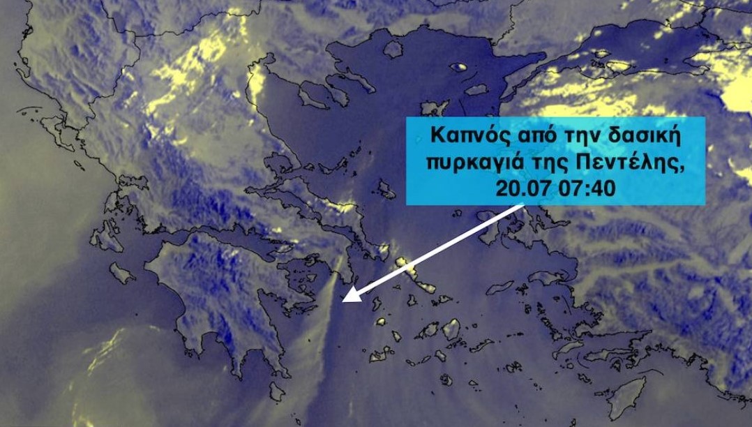
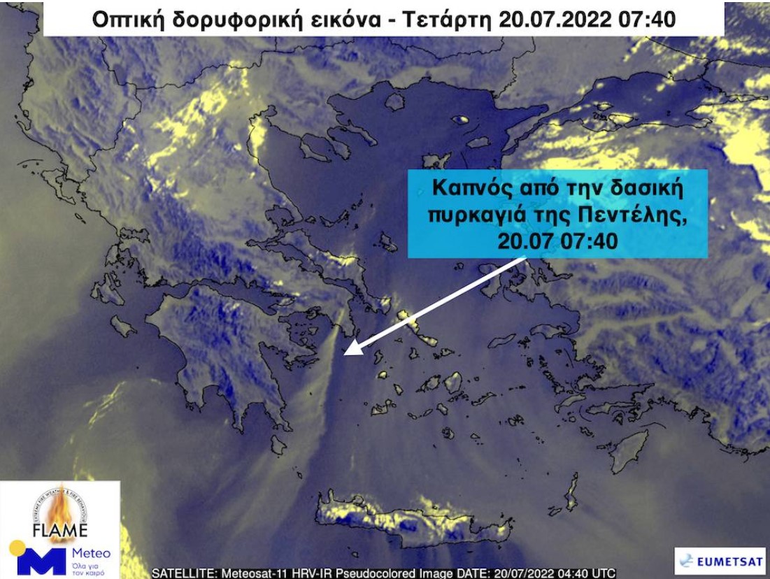
At least 400 kilometers south-southwest, toward the Sea of Kythira and the southwestern Cretan Sea, the smoke from the Penteli forest fire has been carried by strong north-northeasterly winds, according to the National Observatory of Athens/meteo.gr.
The photograph taken by the European METEOSAT-11 satellite is telling, as strong north-northeasterly winds are blowing.
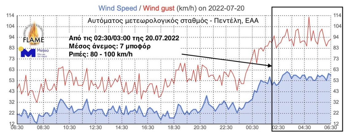
Earlier, the FLAME fire-meteorological team of the National Observatory of Athens (NOA) / meteo.gr, reported that the northerly winds in the area of the fire were strengthened significantly from the the early morning hours on Wednesday, blowing as of this moment (9 a.m.) at average intensities that reach the 7 Beaufort and bursts that exceed the 90–100 km/h.
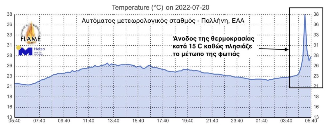
Meanwhile, according to the data recorded by the automatic weather station station from the Hellenic Meteorological Service / meteo.gr at Pallini, it follows that sharp rise of the temperature by 15 points Celsius as the fire front approached the area.
In particular, the temperature between 4:40 and 5:10 On Wednesday, that is, within 30 minutes, it went up from them 23 to 38 degrees Celsius.