Residents' interest in the major project Sewer System and Wastewater Treatment Plant for the Southern Part of Kythira It is intense—and rightly so.
As the work progresses and many streets have already been dug up, residents are wondering:
«Where exactly will the sewer line run?»
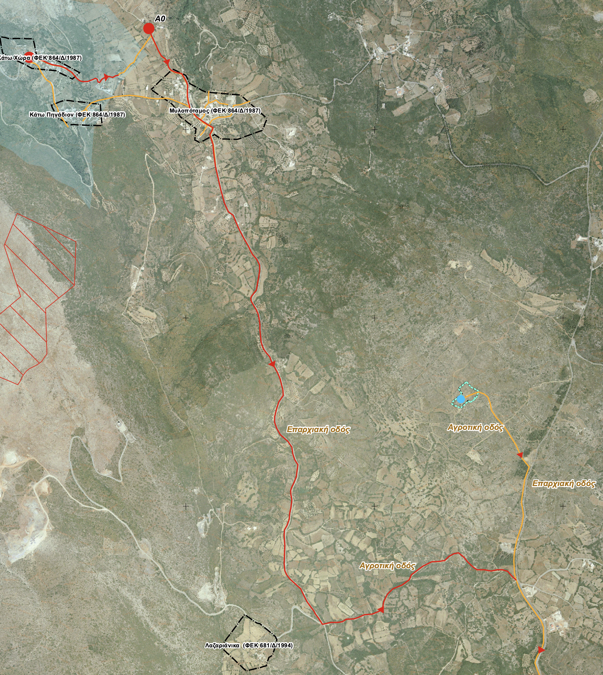
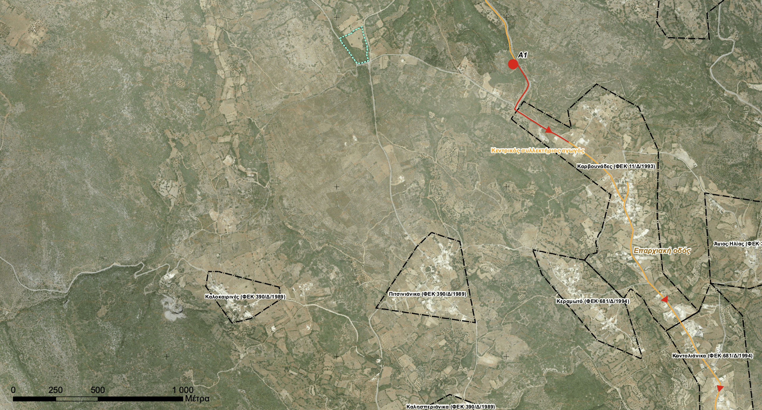
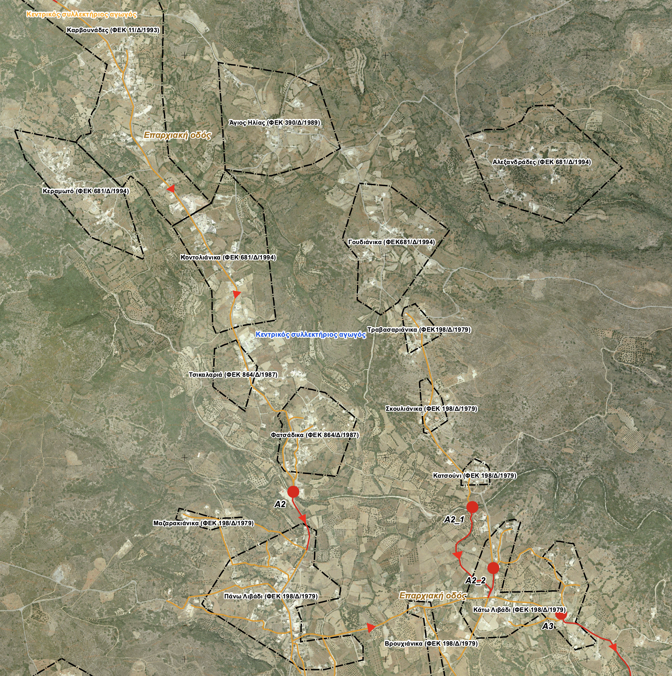
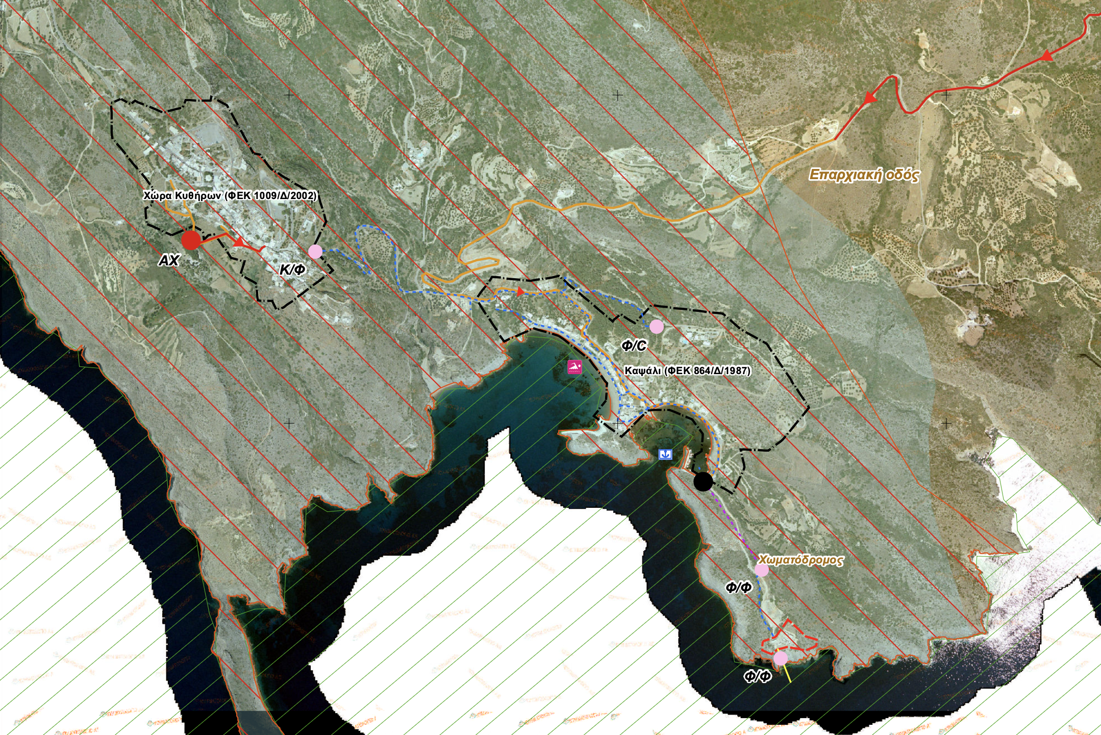
In response to repeated requests, the Kythera.News publishes excerpts from the official maps (3a & 3b) of the Environmental Impact Study for the project (April 2022), with the Municipality of Kythira as the implementing agency and the consulting firm Consultants & Engineers, LLC.
The route of the sewer line
The network covers the southern part of the island, including the following settlements:
Kalamos, Livadi, Katouni, Kontolianika, Karvounades, Mylopotamos and other smaller settlements.
The basic engraving follows the Fratzia–Livadi–Chora–Kapsali highway, through which the main collection pipe, with gravity pipes, antidepressants pipes and pumping stations in key areas, such as:
- A0 (Mylopotamos Cemetery)
- A1 (Kyra Rini Lagkadi)
- A2 (Livadi Stream)
- A2_1 (Katouni Bridge)
- A2_2 (Kato Livadi Square)
- A3 (Levounari)
- A4 (Kalamou)
- AH (Chora Cemetery area).
Η Wastewater Treatment Plant (WWTP) located at southeast of Chora.
Internal Networks and Residential Connections
Of particular interest is how the internal networks of settlements, as these will determine which homes and businesses will be connected to the grid.
According to the study, the following are projected: 450 future connections, with the goal of providing full coverage of the settlements in the south; however, the final number will depend on the specific characteristics of each region.
This point—that is, How many connections will ultimately be made?— These are among the most critical issues expected to be clarified during the final stage of implementation.
A Project That Is Transforming Kythira
The sewer system project, funded by the Recovery Fund, is one of the largest infrastructure projects on the island in recent decades.
Once completed, the project is expected to permanently resolve the wastewater management problem, protect the aquifer, and enhance environmental safety — particularly in areas with a high concentration of tourism.
See the maps for the exact route of the pipelines and the locations of the pumping stations. We’ve included excerpts below, followed by the PDF files. You can download the PDFs and view them on a large screen or print them out.
If you have any questions or comments, please send them to editors@kythera.news
Source: Environmental Impact Study, April 2022 – Municipality of Kythira